Orca Expands into Oceania: Now Covering Australia and the South Pacific Islands – Marine Business News

- by Admin
- November 18, 2024

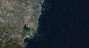
Norwegian marine tech innovator Orca is thrilled to announce its expansion into the stunning waters around Australia, New Zealand, and the South Pacific Islands.
Starting today, Orca users can plan and navigate some of the world’s most iconic maritime landscapes – from Australia’s vibrant coral reefs to New Zealand’s windswept coastlines and the hidden gems of the South Pacific islands.
High-end charts at no extra cost
Orca’s charts are built from an extensive mix of hydrographic data, private sources, and Orca’s in-house collections to ensure an accurate, reliable experience tailored to the specific needs of Oceania.
Jorge Sevillano, Orca’s Co-Founder and CEO, notes, “This launch is a new step in our journey to provide the best charts for boaters globally. Australian charts are not only important to boaters from the southern hemisphere but also to global navigators. As always, these charts are included at no additional cost for existing Orca users.”


Expanding the Orca ecosystem
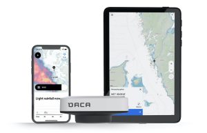
Since launching in 2021, Orca has rapidly become a popular navigation system for sailors and cruisers worldwide. Orca combines a free navigation app with the Orca Display 2 – an ultrabright, marine-grade tablet, and Orca Core 2 – a smart hub that integrates with boat sensors and instruments. Orca’s smart systems simplify complex routes with features like automatic routing, real-time weather forecasts, and AIS, helping boaters enjoy safe and stress-free journeys.

The Orca app is free to download from the Apple App Store and Google Play. Boaters across Oceania can access the new charts today, and those seeking a complete, integrated navigation experience can find the Orca Display 2 and Orca Core 2 at www.getorca.com.
With this expansion, Orca invites boaters throughout Oceania to experience a new level of intuitive navigation that makes every journey easy and reliable.
The Latest News
-
November 19, 2024‘In the face, that’s Kohli’: Why no player has done more to stoke the Australia-India rivalry
-
November 19, 2024‘Grander plans’ for academy that’s produced 52 A-Leagues players: ‘Exciting for Aussie football’
-
November 19, 2024Why this summer could be ‘the most watched series’ in Aussie cricket history
-
November 19, 2024Aussie Test debutant faces up to fiery practice session
-
November 19, 2024All you need to know for the Border-Gavaskar West Test | cricket.com.au


